

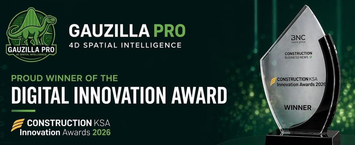
GAUZILLA PRO
Turn any video into AI-powered 4D reality twins — built for AEC, Real Estate, and beyond in the Physical AI era
Gauzilla Pro allows for generating, rendering & editing 3D/4D reality models captured with smartphones, drones, or 360 cameras. Everything runs inside a browser. No installation required.
Architecture, Engineering & Construction (AEC)
Capture your jobsite in photorealistic detail and transform it into an AI-powered 4D reality twin that evolves with every phase of construction.
High-fidelity reality models enable precise progress tracking against BIM schedules, early clash detection, and safer logistics planning—reducing rework, minimizing on-site risk, and keeping stakeholders aligned from groundbreaking to handover.
Real Estate
Give prospective buyers and investors an immersive, true-to-life 3D/4D experience of any property—anytime, anywhere.
Gauzilla Pro delivers a level of visual realism that traditional as-built 3D tours cannot match, driving higher engagement, shortening sales cycles, and empowering confident purchasing decisions before a single physical visit takes place.
Mining & Forestry
Operate smarter across vast, dynamic landscapes by turning remote terrain into navigable and measurable AI-powered 3D/4D reality twins.
Monitor stockpile volumes, track terrain/vegetation change over time, and plan extraction or harvesting operations with centimeter-level spatial accuracy, reducing costly site visits, and supporting environmental compliance from a single capture.
Heritage & Tourism
Preserve culturally or historically significant sites & landmarks as permanent, photorealistic 3D/4D digital records while opening them to global audiences.
Immersive and interactive experiences let visitors explore heritage environments in extraordinary detail—fueling tourism engagement, supporting conservation research, and ensuring that irreplaceable cultural assets endure in digital form for future generations.
Oil & Gas
Digitize complex storage infrastructure and critical assets into inspection-ready, AI-powered 3D/4D environments that can be reviewed remotely and repeatedly.
Identify corrosion, structural anomalies, and maintenance needs without shutting down operations or exposing personnel to hazardous conditions—streamlining compliance workflows, cutting inspection costs, and extending asset lifecycle through data-driven decision-making.
Interactive 4D Time-Lapse
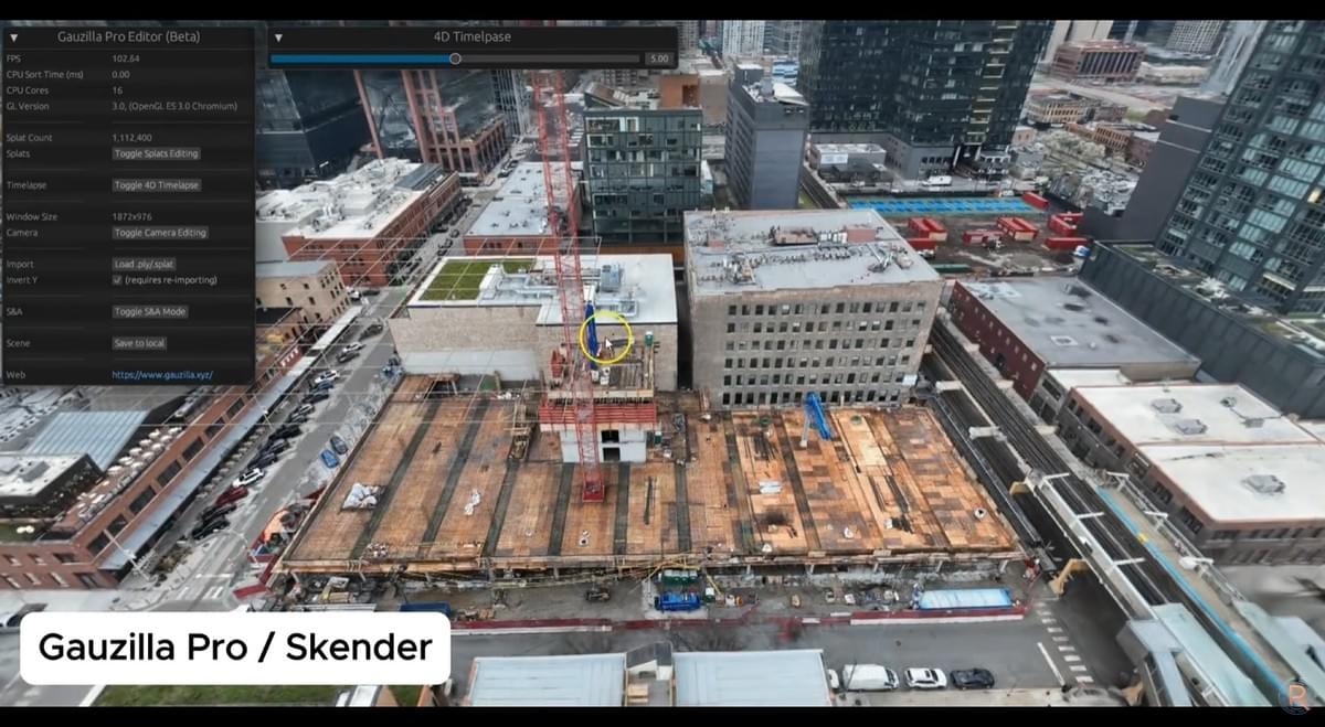
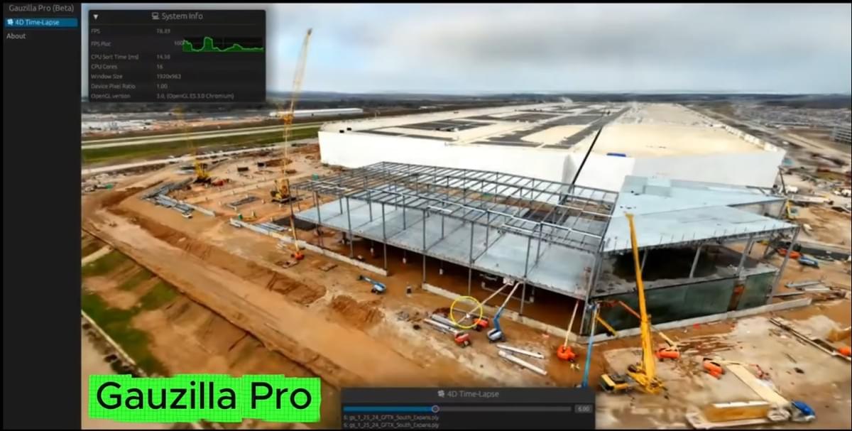
Gauzilla Pro allows for creating a dynamic 4D time-lapse from a series of videos. You can convert video footage into an interactive historical record in 4D running 100% on the web.
✅ 4D time-lapse modeling drastically reduces the need for physical site visits and enhances communications among teams and stakeholders.
City-Scale High-Speed Rendering
Gauzilla Pro allows for creating city-scale large 3D scenes for multi-site virtual tours. It significantly enhances stakeholder communication by replacing time-consuming driving between scattered locations.
✅ Our proprietary LOD-free rendering engine completely eliminates slow data streaming. You can instantly travel between hotspots in milliseconds.
AI-Powered 3D Segmentation & Editing
Gauzilla Pro allows for interactive 3D object segmentation, annotation, editing, as well as measurement in the extremely intuitive installation-free web editor.
✅ Easily turn your videos into accurate, measurable 3D/4D records for detailed documentation, inspection, and maintenance. Embed institutional knowledge directly in the space-time.
3D Geospatial AI (GeoAI)
Gauzilla Pro has powerful GeoAI that accurately detects any objects from nadir (top-down) views. The objects can then be annotated, moved, copied, removed, or exported.
✅ Describe objects in natural language and our GeoAI automatically segments them in 3D. Give your scene a spatial context using AI.
Easy In-App Georeferencing
Gauzilla Pro allows for intuitive in-app georeferencing. Just select 3 points anywhere in your scene and assign a GNSS coordinate (latitude, longitude) to each point.
✅ It works with any pre-generated 3D scene. No additional data (eg. EXIF, SRT) is required. Show the accurate position dynamically on the street map or as 3D Tiles on Cesium.
Multiple & Smooth Air-Ground Fusions
Gauzilla Pro lets you easily create multiple, seamless transitions between drone-based scenes and ground-based ones.
✅ Perfect for end-to-end 3D virtual tours from landscape through exteriors to interiors, accelerating the marketing, sales, and management of large-scale properties and facilities.
360° Video & Image Support
Gauzilla Pro lets you generate photorealistic 3D/4D scenes automatically from 360° videos.
✅ Low-cost yet effective solution to quickly capture the scene. Simply upload an equirectangular video exported from DJI Studio, Insta360 Studio, etc. You can also create panoramic spheres in the scene.
BIM Import & AI-Enhanced Rendering
Gauzilla Pro supports BIM import, bringing design intent and as-built site reality into a single, unified 4D workflow.
✅ Overlay your BIM design model directly onto as-built splats for every snapshot in your 4D time-lapse. Compare what was planned with what was built, week by week, or even day by day, for precise progress tracking and analysis across AEC projects.Pricing

Generator
✅ Unlimited 3D generation
✅ Basic 4D editor
̶$̶1̶9̶9̶
$0
per month
(until 2026.12.31)
Most Popular

Pro
✅ All-in-one
(Generator + Editor)
✅ High-priority 3D gen
✅ Onboarding video call
̶$̶3̶9̶9̶
$266 (33% off)
per month
(billed every 3 months)
FAQs
What is the underlying technology?
Gauzilla Pro utilizes the latest & groundbreaking reality capture technology called 3D Gaussian Splatting (3DGS). Unlike traditional textured mesh-based photogrammetry, 3DGS can accurately reconstruct a wide variety of materials, such as reflective windows, semi-transparent tree leaves, thin power cables, etc. Watch our tech talk to learn more about 3DGS.
What data will I need?
Gauzilla Pro lets you generate photorealistic 3D scenes in our cloud NVIDIA GPU servers. You can upload regular RGB videos captured with any device, such as smartphones or aerial drones. We also support equirectangular videos captured with 360-degree cameras (eg. Insta360, Osmo360). For experienced professionals, Gauzilla Pro also supports COLMAP datasets created with professional tools (eg. RealityScan, Metashape).
How should I capture a video?
Since the 3DGS is a machine learning (ML) technique, the garbage-in garbage-out principle still applies - i.e., the 3D reconstruction quality is sensitive to its input. Our general recommendation: 1) make sure to move the camera/drone slowly to avoid motion blur, 2) keep the zoom factor constant, 3) avoid sudden and large changes in exposure, and 4) create as many parallaxes as possible during the capture.
How long does it take to generate 3D?
Processing time on our cloud GPU servers varies greatly depending on the data size. On average it's around 30 minutes for a COLMAP dataset or 1.5 hours for a video or 3 hours for an equirectangular video (excluding waiting time in the queue). The Pro tier has a high priority, allowing you to skip the line.
Can I create 3D/4D scenes on-premise?
Absolutely. For instance, you can use Brush (free & open-source) to generate scenes locally on Windows, Mac, or Linux, and import the result into Gauzilla Pro, which stores all project files locally within the web browser. No upload is required for data import (internet access is required for user authentication).
Can I create a georeferenced scene?
Yes! There are two ways in which you can do it. 1) Place traditional GCP markers when capturing a video, then detect the markers in photogrammetry software eg. RealityScan and generate a georeferenced point cloud. 2) Use the in-app georeferencing tool on Gauzilla Pro that allows you to assign GNSS coordinates to any control point in the scene.
Media Coverage
Powered by

Contact Us
Waldek Technologies is a DeepTech startup specialized in 4D spatio-temporal intelligence for Physical AI.
Ahtri 12, 10151 Tallinn, Estonia






Waldek Technologies © 2024-2026